After you already got to know about all the delicious food and how to get around in the first and second part of the Lisbon series, the third part will be all about sightseeing tips. In addition, we will tell you our favorite viewpoints. As there can be found quite some of them in the City of Seven Hills.
Here you can see the other parts of the series:
- Eat
- Explore
- See
- Sleep
- Surroundings
See.
As already in the first part about vegan food in Lisbon, we have also created a map for the sights (red) and viewpoints (yellow). In doing so, we have reduced ourselves to the essentials, so that it’s possible to trudge round all these points during a day trip if necessary. Those who spend more time in the Portuguese capital will, of course, encounter some more beautiful corners.
Sights
Let’s start with the sights. Some of them can be visited free of charge every Sunday or at least every first Sunday of the month from 10 am to 2 pm. For example the Torre de Belém, the Mosteiro dos Jerónimos or the Panteão Nacional.
However, this is no longer an insider’s tip, so that eternally long queues arise at the mentioned attractions. If you still would like to visit them for free, we recommend you to bring enough time and sun protection. As the conditions change from time to time, you should also inform yourself beforehand once again, where you can currently enter free of charge.
TORRE DE BELÉM
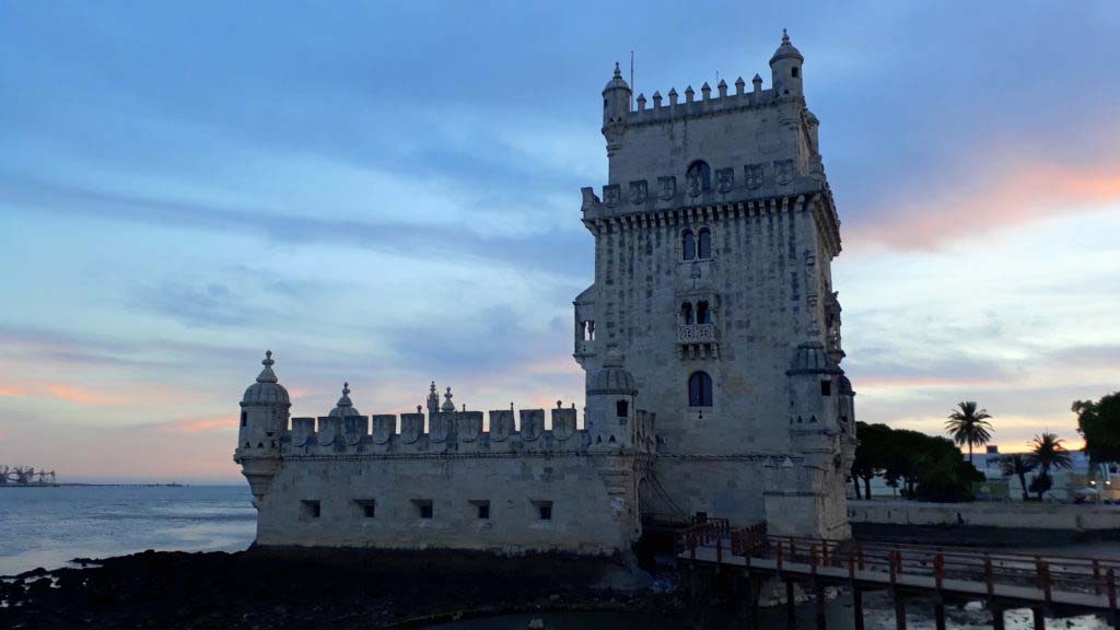
The Torre de Belém (red number 1 on the Sightseeing Map) is one of the most famous landmarks of Lisbon. Since 1983 the lighthouse built in 1521 has been a UNESCO World Heritage Site. Originally there was a second tower on the opposite side, but it was destroyed by the great earthquake of 1755. The gloomy interior served as a prison and armory until the 19th century. Today, the top, free-standing floor of the 35-meter high tower serves as a viewing platform.
MOSTEIRO DOS JERÓNIMOS
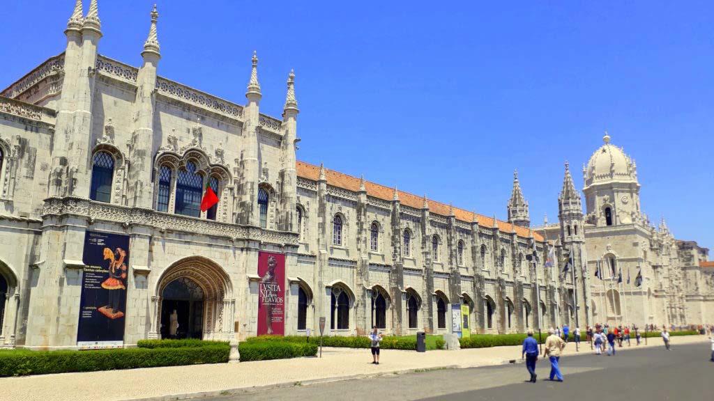
The Mosteiro dos Jerónimos (red number 2 on the Sightseeing Map) has also been part of the UNESCO World Heritage since 1983. The Hieronymit Monastery – as it is called in English – is considered to be the most significant building of the Manueline, a Portuguese version of the late Gothic period. It was commissioned by Manuel I, one of the most important kings of Portugal, shortly after the sailor and explorer Vasco da Gama had returned from his first journey to India. The construction lasted from 1501 to 1601.
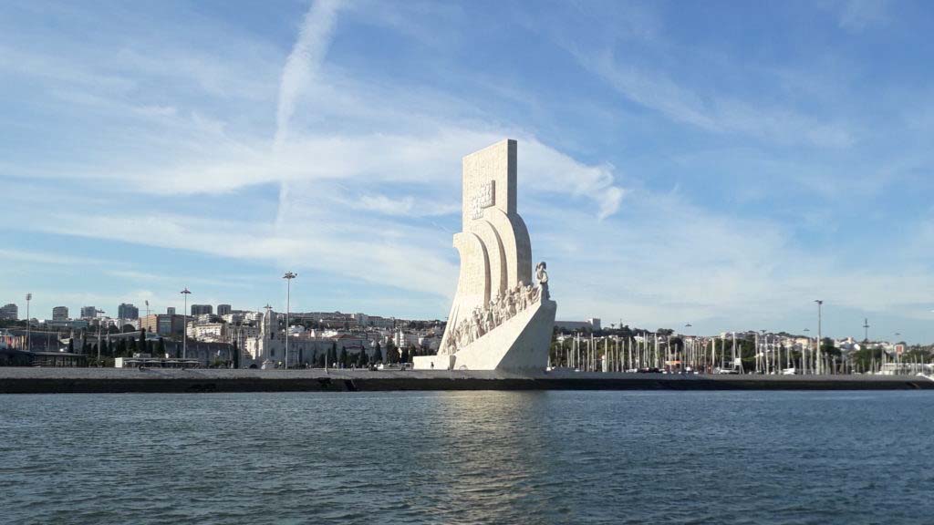
Nearby is also the Padrão dos Descobrimentos (Portuguese for “Monument of the Discoveries”), which was built in 1960 to the 500th anniversary of the death of Henry the Navigator by the Salazar regime. It shows 33 important personalities of the Late Middle Ages in Portugal, but they have not lived all at the same time.
The use of the euphemism “discoveries” in the name is one reason why we did not include it on the Sightseeing Map. We personally find denoting a colonization, which has resulted in genocide, repression, loss of culture, and many other terrible things, trivialized and euphemistically as “Age of Discovery”, – sorry for the expression – absolutely sickening. During our stay in Lisbon, we were shocked at how often and seemingly self-evident that term is still used. One would think that one would have to know better these days. Nevertheless, we don’t want to deprive you completely of the monument, so we still show you a photo. We just hope that you are more sensitive to your language usage.
PONTE 25 DE ABRIL
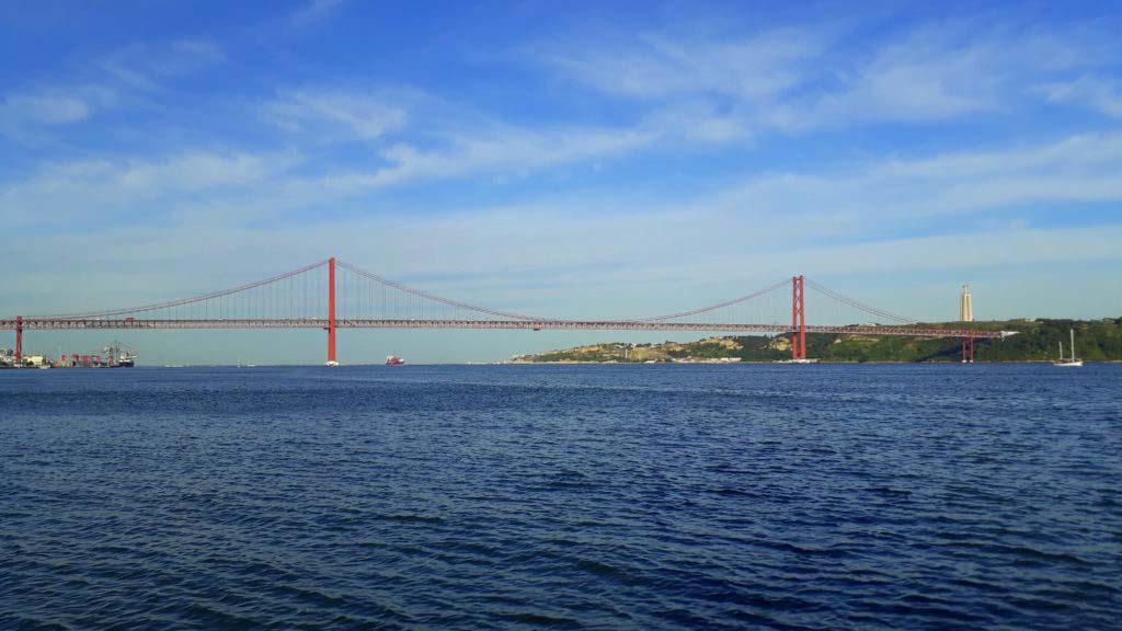
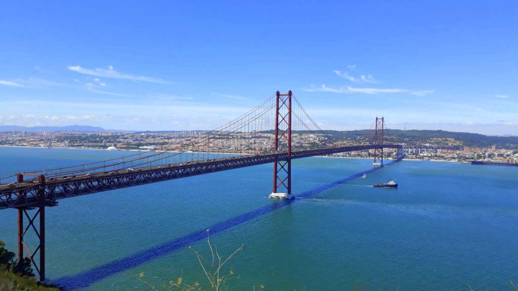
The Ponte 25 de Abril (red number 3 on the Sightseeing Map) is often compared to the Golden Gate Bridge in San Francisco – justifiably. Because of the red color and the framework-like stiffening beams, the two suspension bridges are in fact very similar, even though the Lisbon version is slightly shorter and lower.
However, it is the third longest suspension bridge with combined road and rail transport in the world. The actual model is namely also double-decker San Francisco Bay Bridge. On six car and two railroad tracks, the Ponte 25 de Abril connects the Lisbon district of Alcântara with the city of Almada in north-south direction.
LX FACTORY
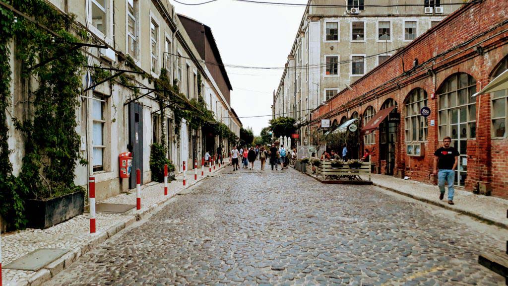
The LX Factory (red number 4 on the Sightseeing Map) has already been mentioned in the first part of our Lisbon series, because here you can eat deliciously vegan in the café The Therapist. On an abandoned factory site just below Ponte 25 de Abril in Alcântara, an alternative island of creativity has emerged which provides space for co-working spaces, agencies, studios, cafés, bars, restaurants and small shops. Theater performances, concerts, exhibitions and workshops also take place here.

BASÍLICA DA ESTRELA
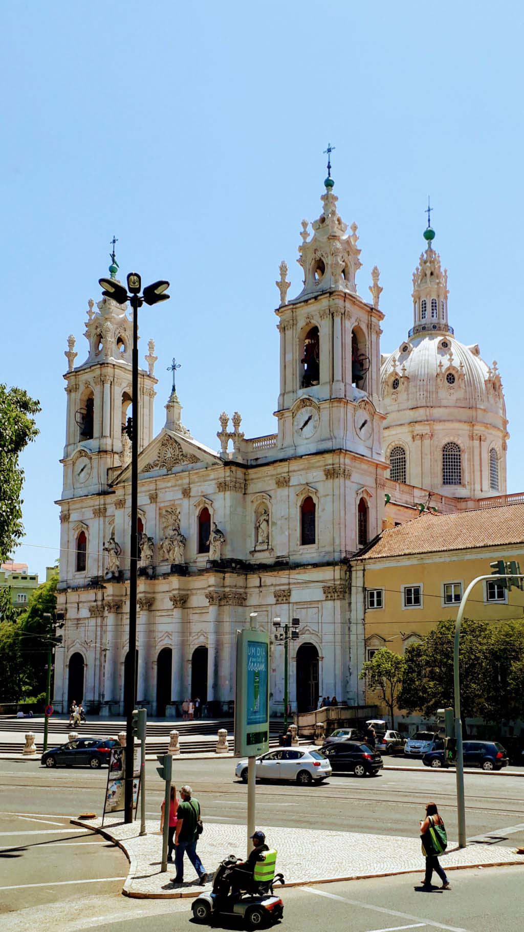
The Basílica da Estrela (red number 5 on the Sightseeing Map), actually Real Basílica e Convento do Santíssimo Coração de Jesus, is a church and ancient carmelite convent. The building was commissioned in 1777 in gratitude for a male heir to the throne by Queen Maria I, the first woman on the Portuguese throne. However, he didn’t have much of it: It was completed only in 1790, after Prince Joseph had already succumbed to the smallpox in 1788.
TIME OUT MARKET LISBOA
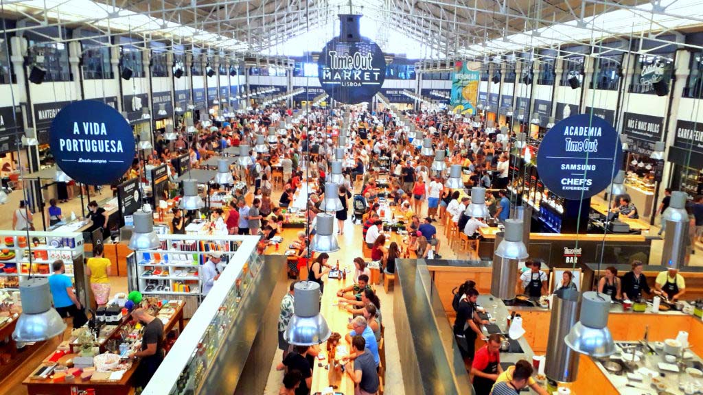
The Time Out Market Lisboa (red number 6 on the Sightseeing Map) is located in the Mercado da Ribeira, a market hall built from 1876 and opened in 1882. From the beginning of the 1990s, the first floor of the building was transformed into a cultural center, where various musical events have taken place since then.
In 2014 the west wing of the market hall was completely redesigned and the Time Out Market Lisboa was the first of several planned joint venture market halls to move in. Here, fast food, nouvelle cuisine as well as traditional Portuguese cuisine with 35 food stalls with wooden benches and tables for guests find a new urban attraction. The food sellers mainly offer regional products.
PRAÇA DO COMÉRCIO
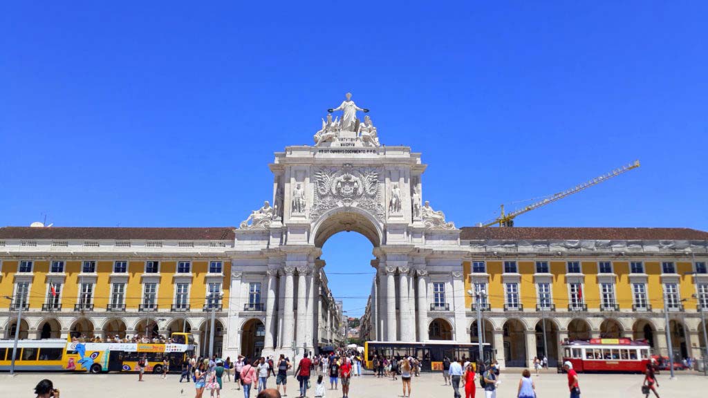
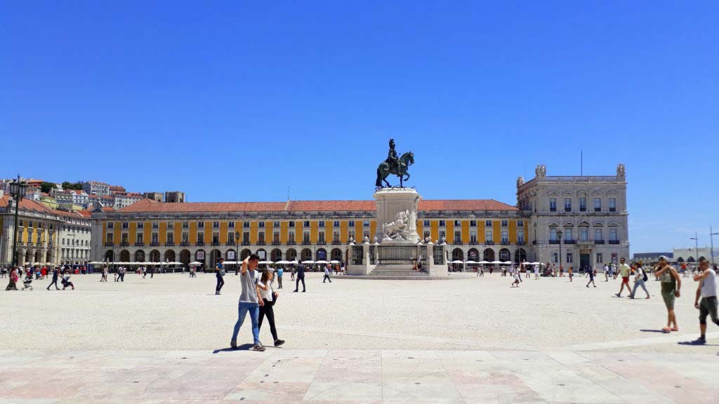
The trade venue Praça do Comércio (red number 7 on the Sightseeing Map) is one of the most important squares in Lisbon. Located directly at the Tagus River, the square is still known as Terreiro do Paço (“palace grounds”), because the royal palace Paço da Ribeira (“palace on the bank”) was located here until the devastating earthquake of 1755.
In Lisbon the quake demanded a high number of victims. The royal palace and a large part of Lisbon’s downtown were destroyed by the subsequent tsunami and a huge fire. After the earthquake, the site was given a completely new form within the framework of the urban reconstruction initiated by the Marquis de Pombal.
Until the 1990s Praça do Comércio served as an autoparking place. Today, there is a strict ban on parking, so the square became a popular event area.
PRAÇA ROSSIO
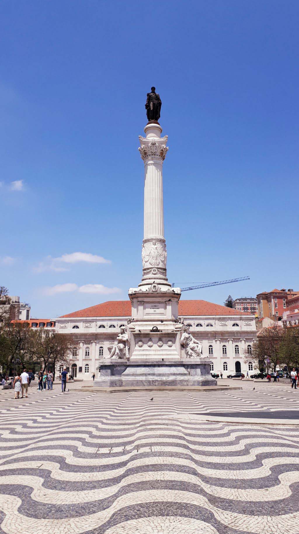
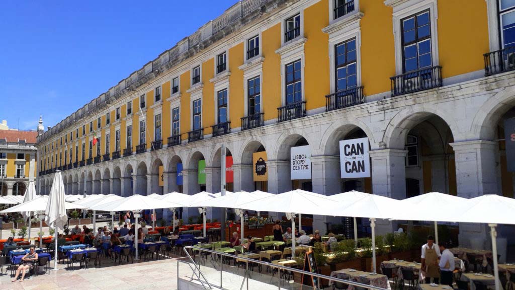
The square Praça Rossio (red number 8 on the Sightseeing Map), officially Praça de Dom Pedro IV, is besides Praça da Figueira and Praça do Comércio one of three main inner squares of the Portuguese capital. However, this meaning came to it as early as from the 13th and 14th century. At the time, Lisbon expanded further to the banks of the Tagus River, and more and more inhabitants now lived around the mountain of the Castelo de São Jorge. The name Rossio means roughly “field without residents” in ancient Portuguese.
The square is located in the heart of Lisbon and has been the center of the city since the Middle Ages. It has been the setting of many celebrations and revolts. Today it is a popular meeting place for Lisbon natives and tourists alike. Within Lisbon, the Rossio is an important transport hub.
The current, official name Praça de Dom Pedro IV reminds of the Portuguese King Pedro IV, the later Brazilian emperor Pedro I, whose bronze statue is located on a column in the middle of the square. The wavy mosaic pattern was laid out on the square in the 19th century. It is typical of Portugal and symbolizes the connection to the sea and the seafaring.
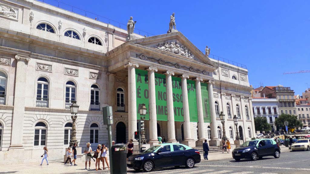
At the northern end of the square is the theater Teatro Nacional Dona Maria II. It was built between 1842 and 1846 and opened on the 13th of April 1846 during the celebrations for the 27th birthday of Queen Maria II. However, a fire destroyed the building, except for its exterior walls, completely. It was rebuilt in the original way and reopened only in 1978.
We also have a tip for you: The 45-meter-high Elevador de Santa Justa, also known as Elevador do Carmo, is considered a public transport and is therefore included in the normal day ticket. From there you can enjoy a beautiful view over the Praça Rossio.
CATHEDRAL (SÉ DE LISBOA)
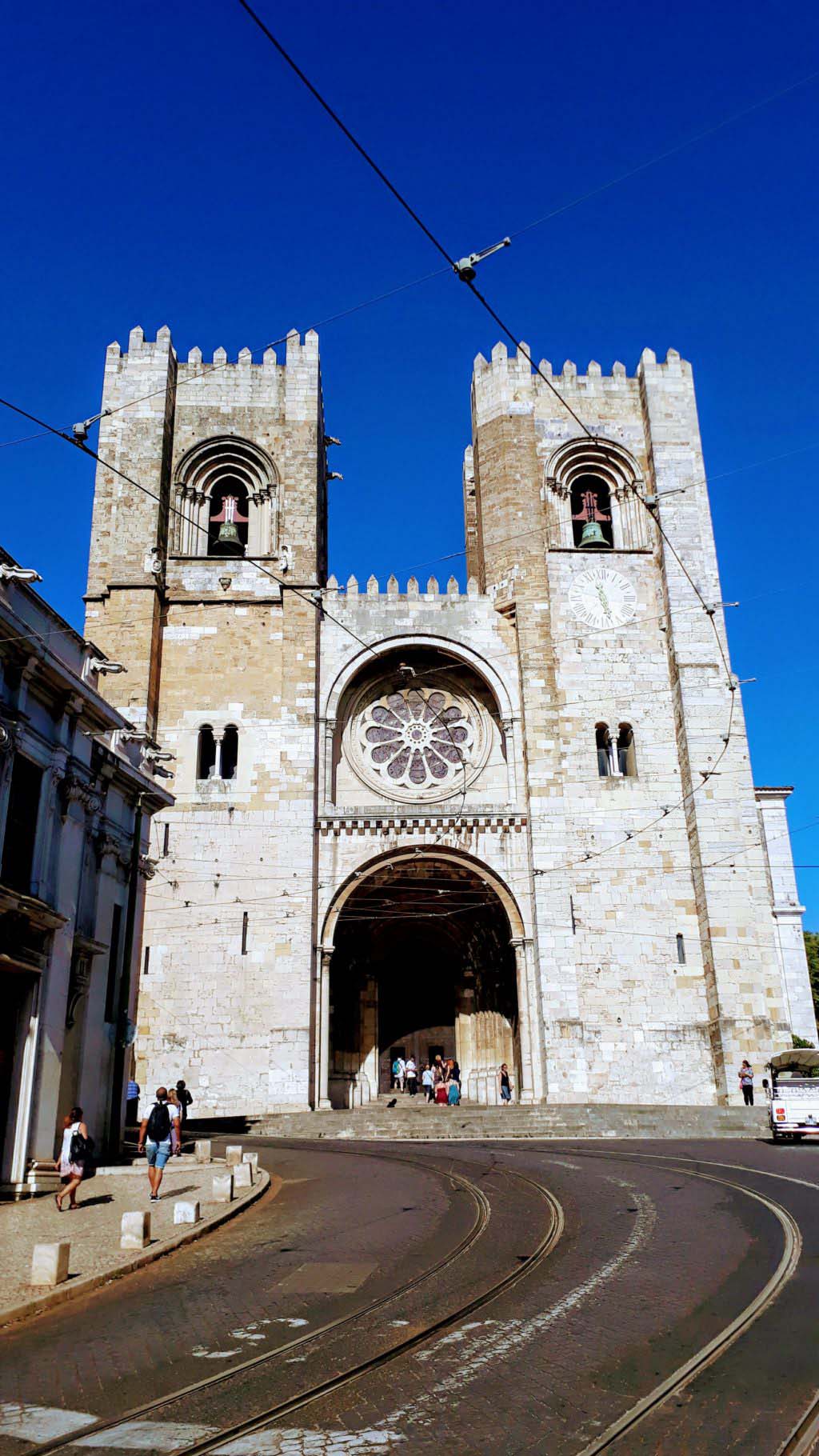
The Cathedral Sé de Lisboa (red number 9 on the Sightseeing Map), also called Igreja de Santa Maria Maior, but usually simply called Sé, is the main church of Lisbon. The building is located at the site where a mosque once existed. Construction began in 1147, making the cathedral the oldest church in the city.
In 1380 the western facade was built in the style of Romanesque architecture. After an earthquake had already caused some damage in 1344, the earthquake of 1755 again caused damage, among other things the Gothic choir was destroyed. In the 18th century the towers were crowned with battlements, which were dismantled during the Salazar reign, to be restored shortly thereafter. In addition, the window similar to a portal in the west facade was replaced by a rose window.
PANTEÃO NACIONAL
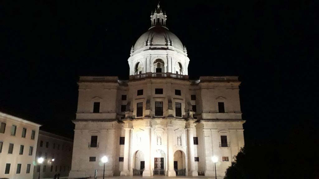
The Panteão Nacional (red number 10 on the Sightseeing Map) is located in the Igreja de Santa Engrácia. The great baroque church of the 17th century, which could only be completed in the 20th century, was never used as a god-house. The present building of the Igreja de Santa Engrácia replaced several churches already in the same place, which were also named after the martyr of Braga from the 12th century, the holy Engrácia.
The first construction work for the present church building began in 1681, after the previous one had been collapsed. João Antunes, royal architect and at the time one of the most famous Baroque architects of Portugal, took the management of the construction. The construction work on the new church went on until 1712, until Antunes died. The then King João V had no interest in the new church in Alfama. He preferred to invest the tax revenues in the gigantic National Palace of Mafra, the largest castle and monastery complex in Portugal.
Therefore the church remained unfinished until the 20th century. As a result, the saying Obras de Santa Engrácia, in English “construction works of Santa Engrácia”, became a synonym for long, incomplete works in the general language usage. Ultimately, the Portuguese policy during the Estado Novo (dictatorship under Salazar) decided to finish the church. Thus, the church, especially the dome, was completed and consecrated until 1966.
In the same year, the church was transformed into a national pantheon after the French model. Therefore, some persons were later exhumed to be buried in the Igreja de Santa Engrácia. “Celebrities” like state presidents, writers as well as a fado singer and a soccer player are buried here. There are also some cenotaphs (sham graves) for “heroes of Portuguese history” like Vasco da Gama and Henry the Navigator.
Since August 2003, the Monastery of Santa Cruz in Coimbra also has the status of a Panteão Nacional, since the first two Portuguese kings, Afonso Henriques and Sancho I, are buried there. That’s why since then, there are two buildings in Portugal, which equally bear the name Panteão Nacional.
FONTE LUMINOSA
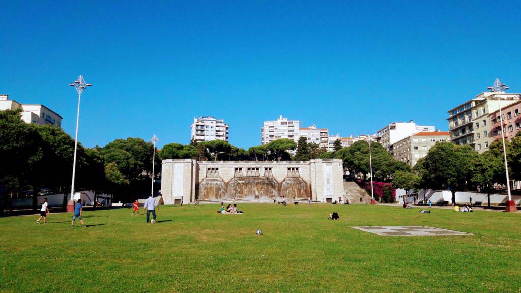
The monumental fountain Fonte Luminosa (red number 11 on the Sightseeing Map) was built between 1939 and 1943 in the district of Alto do Pina, forming the eastern end of the Alameda Dom Afonso Henriques. The construction was carried out by the two architects Carlos and Guilherme Rebelo de Andrade. The central fountain figures were created by Diogo de Macedo, the women’s statues on the basin by Maximiniano Alves.
The name of the “luminous fountain” derives from the light show, which takes place every night about 15 minutes after sunset. Every afternoon and evening there are also water shows. However, due to the constantly required maintenance, and to the high costs, the fountain is not always working. Two stairs on the sides of the monument lead up to the top. From there you can see the fountain from above and have a nice view over the avenue.
PARQUE DAS NAÇÕES
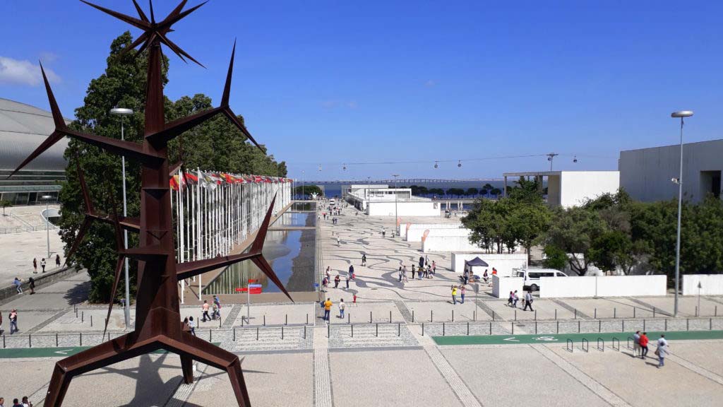
The civil parish of Parque das Nações (red number 12 on the Sightseeing Map) is the former exhibition site of the Expo 98. With the decision for Expo 98 and its theme “The Oceans: A Heritage for the Future” began the complete reconstruction of the former industrial area.
In doing so, the political instances focused on modern architecture in order to create a counterpoint to Baixa de Lisboa, the inner city of Lisbon, and to establish the area as a new tourist destination. From the outset, after-use has been sought for all buildings.
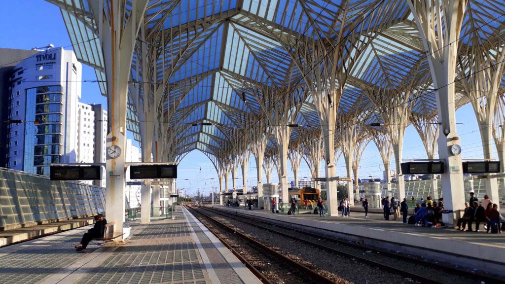
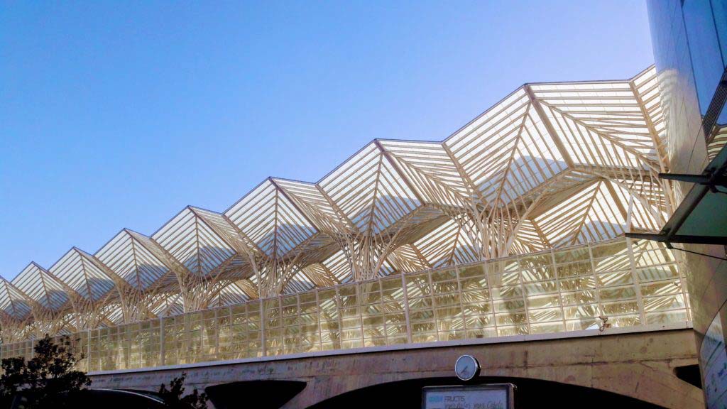
The Estação do Oriente station, designed by Santiago Calatrava, is the centerpiece of the Parque das Nações. The tracks are covered by a very light-looking roof structure made of glass resting on tree supports. From the station there are numerous train connections to almost all parts of the country. The Linha Vermelha of Metro Lisbon ensures a connection to the city center.
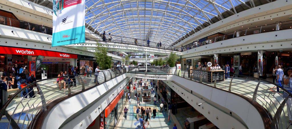
The Vasco da Gama Shopping Center, which had the function of a reception building for the world exhibition during Expo 98, is also worth a visit. Behind the shopping center is the Pavilhão Atlântico, during the Expo called Pavilhão Utopia, now a multifunctional hall. Major concerts of well-known bands usually take place in this hall.
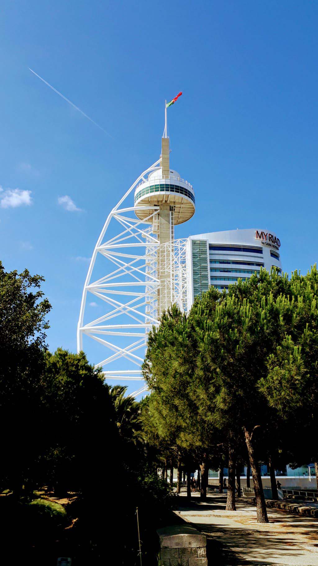
To the north are now the International Exhibition Halls, where the new Lisbon fair center Feira Internacional de Lisboa has established. Next to the fair, the 145-meter-high observation tower with connected hotel building Torre Vasco da Gama provides a view over the Tagus and the Parque das Nações itself. It is the tallest building in Portugal.
The exhibition grounds also include the former Pavilhão do Futuro (future pavilion), now home to the Lisbon Casino, and the Pavilhão do Conhecimento (knowledge pavilion), now the Lisbon Science Museum.
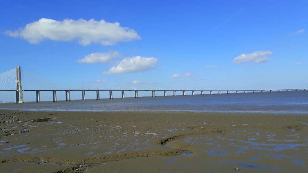
The Ponte Vasco da Gama was also built between 1995 and 1998 for the Expo 98, to relieve the Ponte 25 de Abril as well as other infrastructures of Lisbon from north-south traffic. It spans the Tagus River and connects the Parque das Nações by motorway with the southern towns of Montijo and Setúbal. It was named after the Portuguese navigator Vasco da Gama and commemorates the 500-year-old discovery of the sea route to India in 1498. With a length of 17.185 kilometers, it is one of the longest bridges in the world and the longest in Europe.
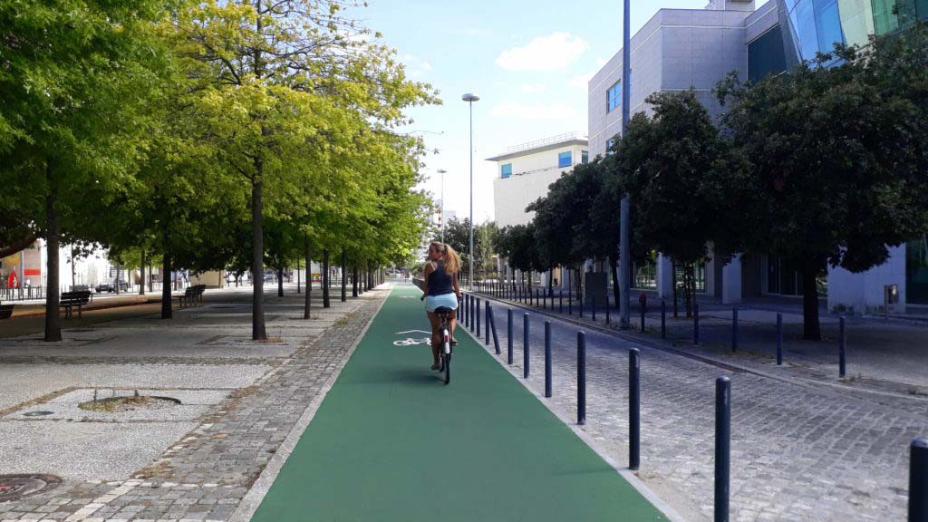
As already mentioned in the second part of the Lisbon series about the means of transport, there are actually cycle paths here. That way, you can explore the Expo terrain also by bike and cycle along the Tagus trip the almost 16 kilometers to the Torre de Belém during a day.
